Anaximander's world map, or how a philosopher drew the whole earth
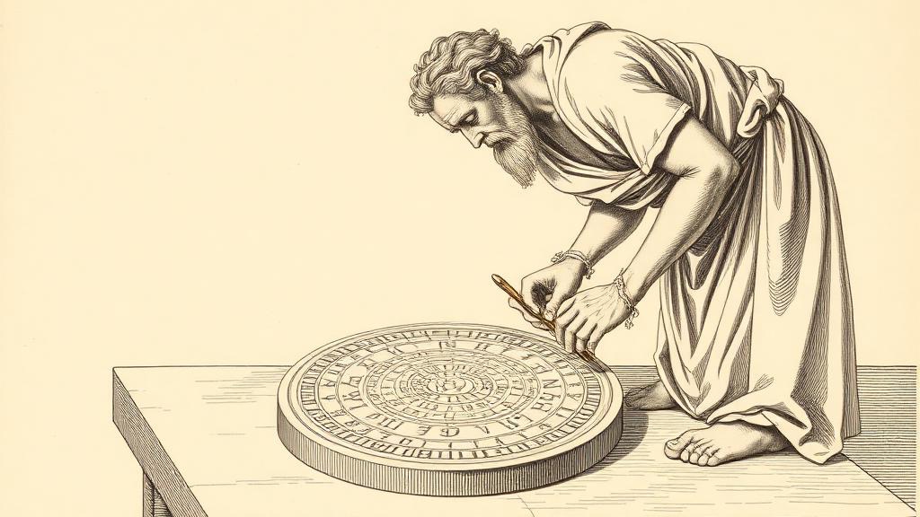
In a workshop in Miletus, around 550 BCE, Anaximander pressed a stylus onto a metal plate and drew a circle. Inside it he placed the Mediterranean, three continents, and the rest of the inhabited world — all of it ringed by an ocean he believed flowed without end. The result was, by all accounts we have, the first published map of the world. None of it survives.
Miletus sat on the western edge of Ionia, the Greek-speaking coast of what is now Turkey, and in the sixth century BCE it was the most productively argumentative place on Earth. Anaximander had studied under Thales — the philosopher who concluded that everything was made of water and who, in 585 BCE, reportedly predicted a solar eclipse well enough to stop a battle mid-fight when both armies panicked at the darkening sky. Anaximander disagreed with his teacher about the water. He proposed instead “the apeiron,” the boundless, as the source of all things. But he inherited Thales’s conviction that the universe was something you could think about rigorously, without invoking gods.
The map is known entirely through reports of reports. Strabo, writing in the first century BCE, and Agathemerus, writing in the third century CE, both credited Eratosthenes — the Alexandrian librarian who would later calculate the Earth’s circumference — as their source. Eratosthenes himself was writing three centuries after Anaximander. The chain has three links, all of them centuries long. What they agree on: the map was circular, the Aegean Sea at its center, three landmasses inside the ring — Europe, Asia, and Libya — divided by the Phasis River in the northeast and the Nile in the south, the whole disk floating in the surrounding ocean.
Placing your home city at the middle of the world is not a coincidence. The Babylonian clay tablet from half a century earlier had put Babylon at the hub; Anaximander put Miletus. Later geographers noted that Thales had been trying to persuade the Ionian city-states to federate against the Median threat from the east — and a map that showed the Greek world as a coherent, bounded whole would have served that argument well. It is among the earliest cases of a map deployed as political instrument. Not the last.
Anaximander’s stranger contribution sits underneath the map entirely. He had already concluded, on purely philosophical grounds, that Earth was a free-floating cylinder suspended in space — it had no more cause to fall one way than any other, so it stayed put. Twenty-five centuries later, Karl Popper would name this one of the most audacious ideas in the history of human thought. The same mind produced both the cosmology and the map, which suggests that the impulse to draw the world and the impulse to explain it were, for Anaximander, the same impulse.
Hecataeus of Miletus, born a generation after Anaximander died, took the map and improved it — refining coastlines, pushing Libya further south, incorporating accounts from travelers his predecessor had never met. The template held: circle, center, three continents, ocean at the edge. It would hold all the way to Ptolemy.
The map itself is gone. What remains is the idea it required: that the whole world is something you can draw on a single surface — bounded, arranged, comprehensible. That idea turned out to be considerably more durable than any metal plate.
Sources
- Anaximander — Wikipedia — biographical details, the world map attribution via Strabo and Eratosthenes, the apeiron, the floating-cylinder cosmology, and Popper’s assessment.
- Anaximander’s Map — Digital Maps of the Ancient World — map design including the likely metal surface, geographic features, and the Thales/Ionian federation context.
- Hecataeus of Miletus — Wikipedia — Hecataeus’s improvements to Anaximander’s map and his role in the Greek geographical tradition.